
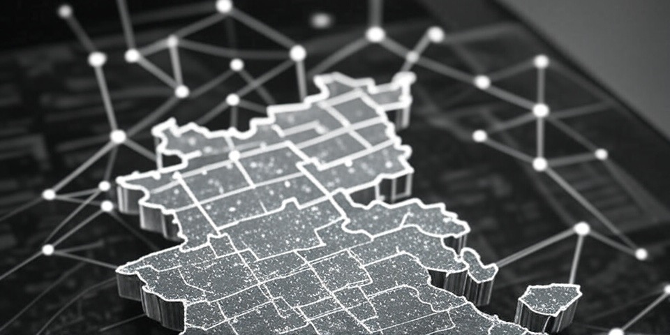
The term “geoblockchain” may sound unfamiliar, but it’s a real and emerging concept that combines geospatial data with blockchain technology. For those new to the idea, breaking it into its components—”geo” and “blockchain”—offers a clear starting point. This post explores what geoblockchain is, how it relates to Geographic Information Systems (GIS), and its practical applications in solving location-based challenges.
Defining the Parts: “Geo” and “Blockchain”
“Geo”: The Spatial Element
“Geo” originates from the Greek word “γῆ” (gē), meaning “earth” or “ground.” It’s a prefix used to denote anything related to the Earth or spatial positioning. Common applications include:
- Geography: The study of Earth’s physical features and regions.
- Spatial/Location: Data pinpointing positions, like geolocation coordinates.
In essence, “geo” focuses on “where” something occurs, providing the spatial context central to geoblockchain.
“Blockchain”: The Secure Ledger
Blockchain is a decentralized digital system for recording information, widely known as the backbone of cryptocurrencies like Bitcoin. It operates as a distributed ledger shared across a network of computers, offering key features:
- Structure: Data is stored in “blocks,” each linked to the previous one via a unique hash, ensuring integrity.
- Decentralization: No single entity controls it; instead, multiple nodes maintain identical copies, validated through consensus mechanisms.
- Attributes: It’s immutable (unchangeable once recorded), transparent (visible to authorized users), and secured by cryptography.
Beyond cryptocurrencies, blockchain supports supply chain tracking, smart contracts, and secure voting systems. In geoblockchain, it provides the foundation for recording location-based data.
Geoblockchain: Combining the Two
Geoblockchain integrates geospatial data—information about specific Earth locations—into a blockchain framework. It leverages the security and transparency of blockchain with the “where” provided by geospatial tools like GIS, IoT sensors, or satellite systems. For example, a block might record a transaction (“10 units shipped”) alongside its location (“40.7128° N, 74.0060° W—New York”) and time, creating a verifiable record.
The Role of GIS in Geoblockchain
GIS, or Geographic Information Systems, is technology that captures, analyzes, and visualizes spatial data. It’s widely used to map and interpret patterns on Earth’s surface, such as tracking disease outbreaks (e.g., the COVID-19 Dashboard) or urban planning.
GIS connects to geoblockchain by supplying the geospatial data—coordinates, maps, or sensor readings—that gets embedded into the blockchain. While GIS organizes and displays location information, geoblockchain secures it, ensuring it remains accurate and tamper-proof.
How Geoblockchain Functions
Geoblockchain operates by combining real-time location data with blockchain’s distributed ledger. Consider a supply chain example:
- Data Input: IoT devices or GIS systems collect location data (e.g., a shipment’s coordinates).
- Block Formation: This data, along with timestamps or other details, is added to a block.
- Network Validation: The block is shared across the blockchain network, where nodes confirm its accuracy.
- Permanent Record: Once validated, it’s locked into the chain, unalterable without network-wide consensus.
This process ensures that location-specific events are securely documented and accessible.
Applications: What Geoblockchain Can Solve
Geoblockchain addresses challenges where location and trust are critical. Below are key areas of impact:
1. Supply Chain Transparency
- Issue: Uncertainty about product origins or authenticity (e.g., counterfeit goods).
- Solution: Geoblockchain tracks items with precise location data at each stage—origin, processing, delivery—ensuring transparency.
- Example: Verifying that seafood was sustainably sourced by logging catch locations.
2. Land Ownership Security
- Issue: Falsified property records in regions with weak governance.
- Solution: Property boundaries are mapped with geospatial data and recorded on a blockchain, preventing disputes.
- Example: Protecting farmers’ land rights with GPS-defined plots.
3. Environmental Monitoring
- Issue: Difficulty proving the source of environmental damage.
- Solution: Sensor or satellite data (e.g., emissions locations) is logged on geoblockchain for accountability.
- Example: Tracking deforestation with timestamped coordinates.
4. Smart City Optimization
- Issue: Inefficient management of urban resources like traffic or energy.
- Solution: Geoblockchain records IoT data with location tags, improving resource allocation.
- Example: Monitoring energy use from solar farms to households.
5. Disaster Response
- Issue: Aid distribution lacks transparency in crises.
- Solution: Geoblockchain tracks supply movements with geostamps, ensuring delivery.
- Example: Confirming medical supplies reach earthquake-affected areas.
6. Insurance Claims
- Issue: Disputes over event locations or timing.
- Solution: Geoblockchain logs weather or sensor data, automating claims via smart contracts.
- Example: Paying farmers for drought damage based on field-specific records.
7. Fraud Prevention
- Issue: Manipulated location data in shipping or services.
- Solution: Geoblockchain verifies and locks in accurate location information.
- Example: Ensuring truck routes match logged data.
8. Public Health
- Issue: Slow tracking of outbreak sources or contaminated products.
- Solution: Geoblockchain maps origins and paths for rapid response.
- Example: Identifying the source of a foodborne illness outbreak.
Why Geoblockchain Stands Out
Geoblockchain’s strength lies in its ability to add a spatial dimension to blockchain’s capabilities. By combining “where” with “what” and “when,” it creates tangible, trustworthy records for physical-world events. It excels in scenarios requiring high trust—global trade, governance gaps, or emergencies—where traditional systems or standalone GIS might fall short.

Explain it to a 6 Year Old
Imagine you have a treasure map that shows where your candies are hidden. GeoBlockchain is like a magic computer map that remembers where stuff is—like your house or a park.
It’s got two cool tricks: “Geo” means places around the world, and “Blockchain” is like a notebook that never lets anyone erase or mess with what’s written. So, if you say, “My candy is buried here!” the notebook writes it down, locks it up, and tells all your buddies so they know it’s real. It’s like a game where everyone shares the same map and trusts it because it’s always fair!